
- 2 h 15 min
- 5,7 km
- Moderate
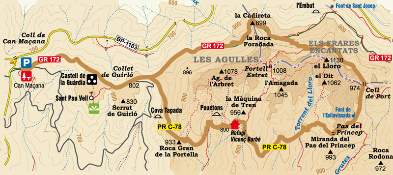
This walk starts at the Can Maçana area, in the direction of the Monastery of Montserrat, along the GR-172, following the Nature Park signs.
At the beginning, you climb up a steep hill along a wide path but the incline gradually eases off.
You'll soon reach the lookout point at the Can Maçana pass, where there's a panel showing the profile of the county of Bages, a large part of the Anoia and the Vallès Occidental, with the Pyrenees in the distance.
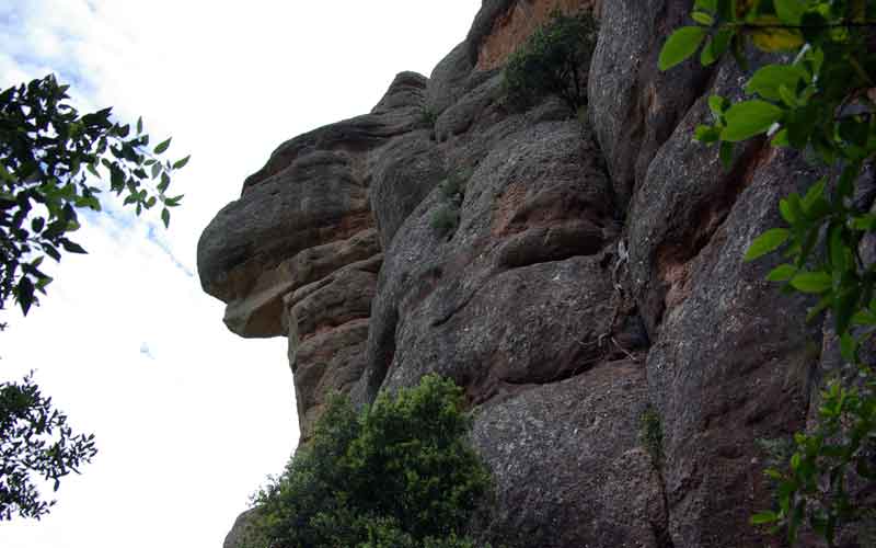
Further on you reach an intersection that leads to Sant Pau Vell, a ruined Romanesque church dating from 1084. Up on the hill you can still make out some remains of the old castle of La Guardia or Boniface, mentioned in records dating back to 973.
Return to the main path and continue in the direction of Roca Foradada and Cadireta, always following the signs towards the Monastery of Montserrat.
A large flat area means you've reached the Guirló pass. A little further on you'll see a path coming from the right in the direction of the Vicenç Barbé refuge, which is the route you'll take on the way back. For now, continue straight on, passing through a wooden gate that prevents bicycles and horses from entering. We should remember we're in a Nature Reserve.
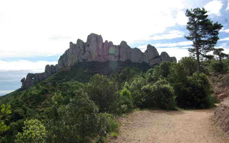
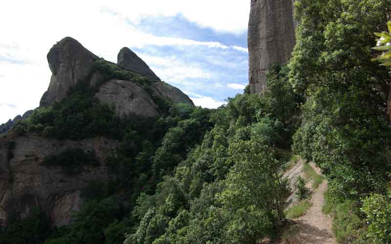
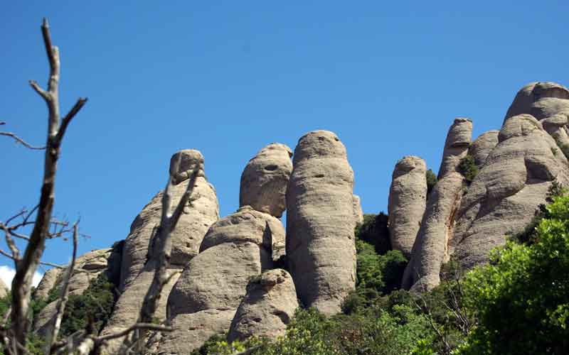
Now you're very close to Roca Foradada and the path takes you just below Cadireta. Here there are often climbers on the rocks, which are popularly called the "Agulles" or needles.
Continue along the GR-172 but keep your eyes open as you'll soon come across a fork, known as Frares Encantats, which is at an altitude of 837 metres. Take the path on the right which leads towards the Port pass, clearly uphill.
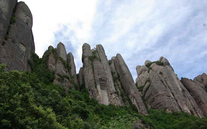
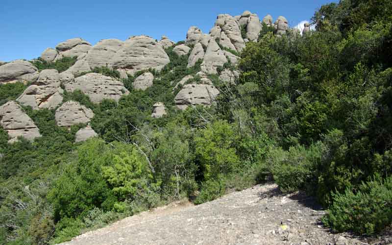
While ascending, you can admire the austere landscape and steep rocky cliffs at Frares Encantats. You'll then come across another intersection. Take the left-hand path in the direction of Port pass.
The path passes between rocks and vegetation with small clearings where you can appreciate the countryside of the municipality of Marganell. You also pass by the spring of Port pass.
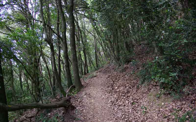
On reaching the pass, you'll find a sign indicating you're at an altitude of 975 metres. Go downhill a little and turn to the right, in the direction of the Vicenç Barbé refuge, along the PR C-78. This path is flat and shaded due to the densely growing oaks surrounding it.
If you look closely, to the right of the path you can see a spring inside a small cave. This is the Esllavissada spring.
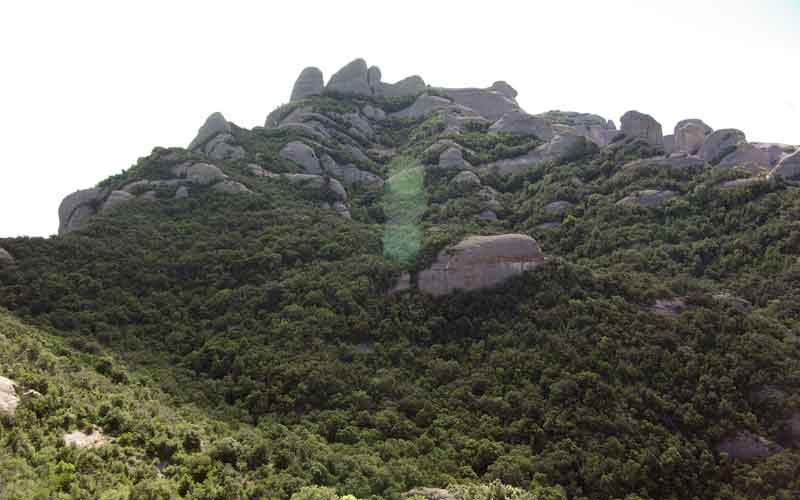
A little further on a clearing appears, revealing the Roca Rodona in the foreground, La Vella on the right and the Ecos zone on the left.
Once you've reached the Pas del Príncep, take the path on the right.
Further on you'll come across an intersection with three paths. Take the one on the left, where you can clearly see the peaks of El Dit and El Lloro.
Now you'll descend for quite a while until you reach the El Lloro water course, where the path runs flat until it reaches the Ampla canal, indicated with a Park sign. Here you're at an altitude of 903 metres. Continue in the direction of the Vicenç Barbé refuge.
This refuge is a small building inaugurated in January 1961, donated by a Bruc resident, Mr. Joan Maria Cases de Muller. Located at an altitude of 900 metres, it can hold up to twenty people.
Leave the refuge and continue to descend along the path marked with the PR C-78 colours (white/yellow).
You'll soon come across an intersection on the left which would take you to the town of Bruc but go straight on towards Can Maçana along the Portella path.
On reaching the Portella pass, you'll see in front of you, imposing, the Roca Grande de la Portella on the left and, on the right, the Roca Pequeña de la Portella.
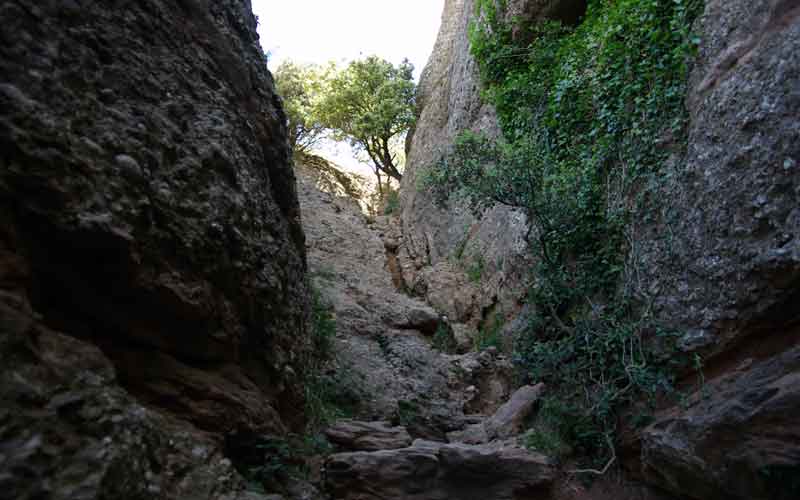
Go down between the rocks, through the Portella pass, taking special care not to slip, especially if it is misty or rainy.
Once through the pass, you'll see the ruins of the church of Sant Pau Vell in the distance. Continue along the path, which will take you back to the start of the walk.
The excursion ends at the Can Maçana area.
Route Map
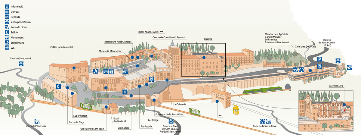
Map of services on Montserrat
Park Rules and Regulations
- Respect private property. Do not walk across cultivated meadows or crop fields.
- Respect cultural and historical heritage. It must be preserved for future generations.
- The capture and/or collection of animals, rocks, minerals or plants is forbidden throughout the Nature Park.
- It is forbidden to discard any kind of rubbish throughout the Nature Park. Always use the bins or take away any rubbish you may have.
No fires must be lit anywhere in the Nature Park.- Free camping is forbidden throughout the Nature Park. For more information on where you can stay, contact the Nature Park's Tourist Information Office.
- Do not make any unnecessary noise. Respect the quiet, especially where birds are nesting.
- All wheeled vehicles are forbidden throughout the Nature Park except on paths and routes open to the public.
- Dogs must be on a lead to ensure they can't disturb any wildlife.
- Walking is the best way to get to know the heritage of our natural places. Follow the signposted routes and paths as it's easy to get lost among the irregular terrain.
Warning! Risk of rock falls.
Basic Tips When on the Trail
- » Before leaving, check the weather conditions and how these might change. Do not undertake the walk if the forecast is not good.
- » Particular care must be taken on cold winter days, in the rain or mist and on hot summer days.
- » Plan your walk and its duration, consulting the guides and the map of the route.
- » Equip yourself adequately for the walk as the weather can change very quickly.
- » Never go alone or at least inform someone of your intended walk. When in a group, always remain in contact with the rest of the party.
- » Keep within your possibilities and remember you have to make the return journey. Carry water in your backpack, drink frequently and eat energy-giving foods.
- » Do not leave the signposted routes or take any shortcut as this results in land erosion.
- » Don't leave any rubbish in the park. Take it with you and place it in the containers or bins provided for the purpose.
- » Hunting is controlled on the mountain in order to maintain a balanced population of game. When planning your walk, consult the dates planned for boar hunts each season.
- » Should an accident occur, call the emergency services on 112. Keep calm and provide the following information:
- →Number of people involved and their age
- →Location of the accident
- →Status of the people involved: Are they injured? Conscious? Bleeding? Breathing?
- →Weather conditions at the location of the accident
Further information
Contact the office of the Montserrat Mountain Nature Park:
Plaça Abat Oliba, s/n, Tel. 938350644Visit our website: