
- 1 h 45 min
- 4,5 km
- Moderate
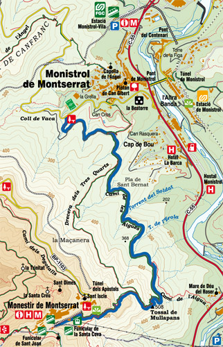
This hill walk starts by taking the small path that comes out of the same area of Coll Cabiró, just where the sign is located. Climb up until you come across a wider track where you should turn left and pick up a gentler slope, in the direction of Montserrat Monastery.
After about ten minutes you should reach the intersection with the GR-96/GR-5 route, a path that goes up to the town of Monistrol located on your left.
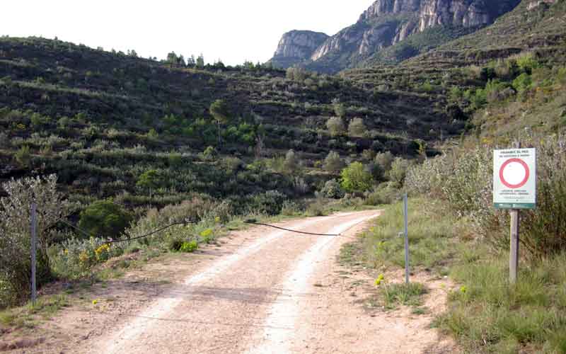
Pass by a hydrant used for putting out fires. Go straight on along the wide track, where you'll see a sign prohibiting motorised vehicles, as well as a mobile fence. Along this part of the path you can enjoy wonderful views of the town of Monistrol.
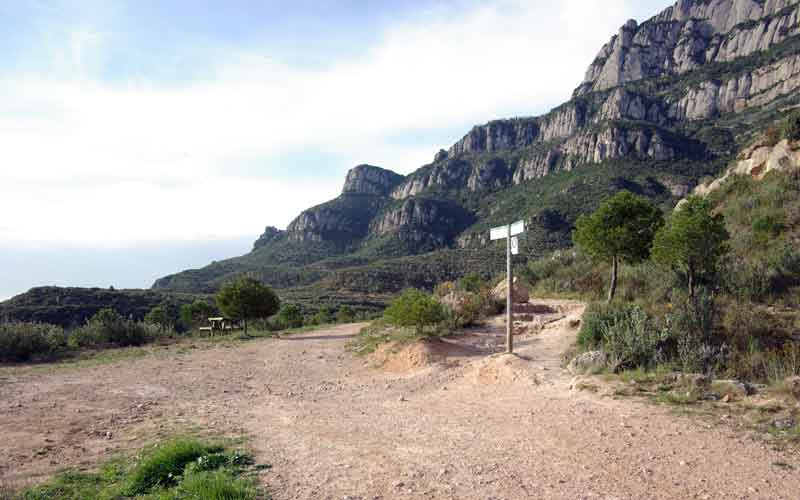
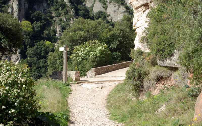
You'll then reach the point where the two GR routes separate, where the path known as La Drecera dels Tres Quarts starts, marked by a sign.
Continue straight on along the same path, the Camí de les Aigües. A few metres further on you'll find a table with benches installed by the ADF of Monistrol de Montserrat, where you can take a break and enjoy views of the north side of the mountain.
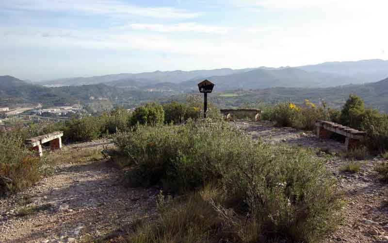
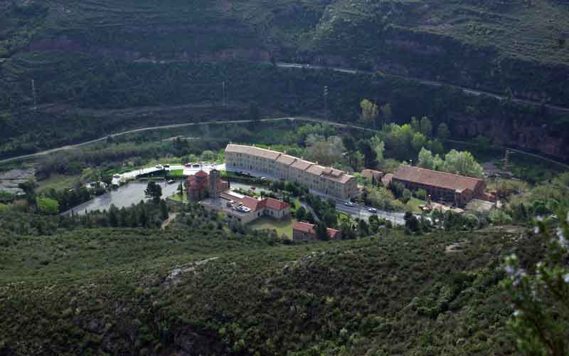
Cross the river course of the Font del Boix along a cement walkway. The path takes you to another flat summit called Pla de Sant Bernat. There used to be a Catalan flag here and a small chapel dedicated to Sant Bernat de Menton. From here you can see the River Llobregat calmly winding its way through the valley and, on the other side, the Cul de Portadora hills.
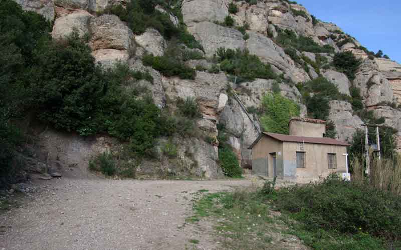
Continue along the track in a southerly direction, leaving behind a path that joins on the left and goes directly up from the cable car station at the bottom. Pass below an electricity line and then, after a sharp bend to the right, you'll see a small stone building. This is the hut for the Montserrat water pumping station.
Leaving the hut to your right, take a path that goes upstream via some steps. The path is very steep and winding, almost always with stone steps. While you're climbing you can see, on a small projection and next to the River Llobregat, the old building of Colonia Gomis, testament to Monistrol's industrial past. Further on, on another projection to the left of the path, you can see the Capella de la Santa Cova (Chapel of the Holy Cave).
Leave La Drecera dels Tres Quarts (GR-96) to the right and turn left, tackling the last steep section, once again via steps. The path runs along the pipe that carries drinking water to Montserrat and over the hill of Les Baranes.
From here, continue along the path until you find the path of the Santa Cova.
Turn right and take the paved path with wide steps that goes up a steep slope parallel to the railway track.
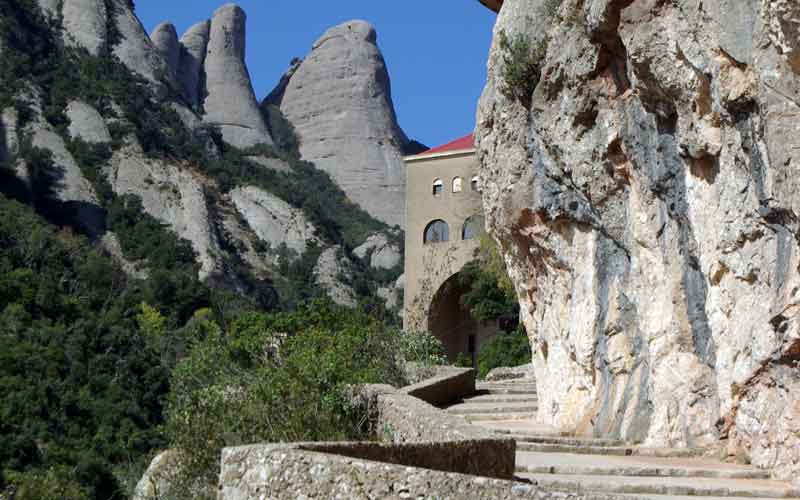
Cross in front of the cable car's top station and, finally, along some narrower steps, you can access Montserrat through the Plaça de la Creu.
Route Map
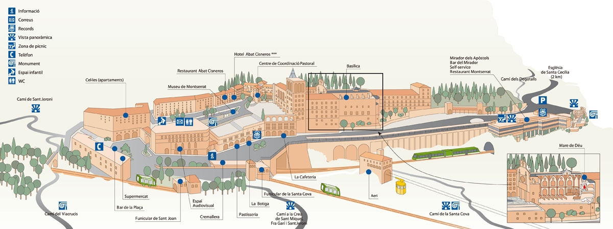
Map of services on Montserrat
Park Rules and Regulations
- Respect private property. Do not walk across cultivated meadows or crop fields.
- Respect cultural and historical heritage. It must be preserved for future generations.
- The capture and/or collection of animals, rocks, minerals or plants is forbidden throughout the Nature Park.
- It is forbidden to discard any kind of rubbish throughout the Nature Park. Always use the bins or take away any rubbish you may have.
No fires must be lit anywhere in the Nature Park.- Free camping is forbidden throughout the Nature Park. For more information on where you can stay, contact the Nature Park's Tourist Information Office.
- Do not make any unnecessary noise. Respect the quiet, especially where birds are nesting.
- All wheeled vehicles are forbidden throughout the Nature Park except on paths and routes open to the public.
- Dogs must be on a lead to ensure they can't disturb any wildlife.
- Walking is the best way to get to know the heritage of our natural places. Follow the signposted routes and paths as it's easy to get lost among the irregular terrain.
Warning! Risk of rock falls.
Basic Tips When on the Trail
- » Before leaving, check the weather conditions and how these might change. Do not undertake the walk if the forecast is not good.
- » Particular care must be taken on cold winter days, in the rain or mist and on hot summer days.
- » Plan your walk and its duration, consulting the guides and the map of the route.
- » Equip yourself adequately for the walk as the weather can change very quickly.
- » Never go alone or at least inform someone of your intended walk. When in a group, always remain in contact with the rest of the party.
- » Keep within your possibilities and remember you have to make the return journey. Carry water in your backpack, drink frequently and eat energy-giving foods.
- » Do not leave the signposted routes or take any shortcut as this results in land erosion.
- » Don't leave any rubbish in the park. Take it with you and place it in the containers or bins provided for the purpose.
- » Hunting is controlled on the mountain in order to maintain a balanced population of game. When planning your walk, consult the dates planned for boar hunts each season.
- » Should an accident occur, call the emergency services on 112. Keep calm and provide the following information:
- →Number of people involved and their age
- →Location of the accident
- →Status of the people involved: Are they injured? Conscious? Bleeding? Breathing?
- →Weather conditions at the location of the accident
Further information
Contact the office of the Montserrat Mountain Nature Park:
Plaça Abat Oliba, s/n, Tel. 938350644Visit our website: