
- 4 h 20 min
- 10 km
- High
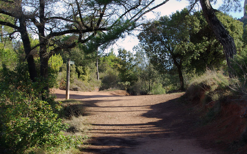
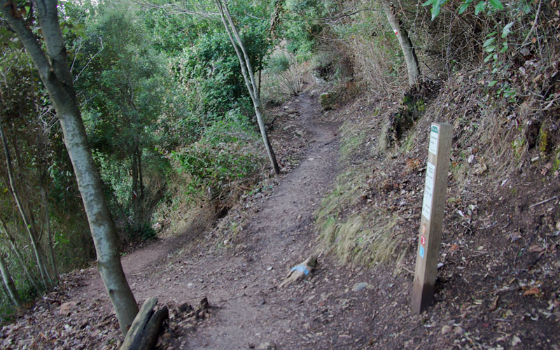
You will begin this route in the area around the mountain pass Coll de Can Maçana, and head towards the Montserrat Monastery, along GR – 172, as you follow the Park signs. This is a wide trail with a slight uphill climb.
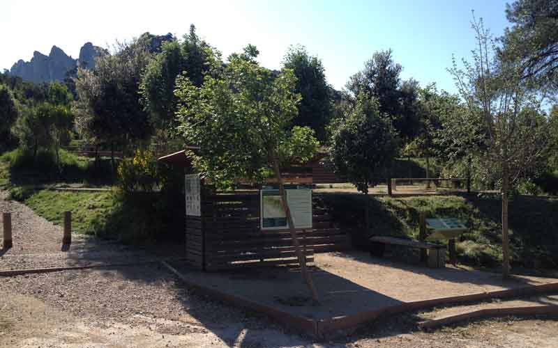
You will soon come to the viewpoint at the Coll de Can Maçana pass, where you will see an information panel that covers the entire El Bages region, much of Anoia and the Vallès Occidental, with the Pyrenees Mountains in the distance.
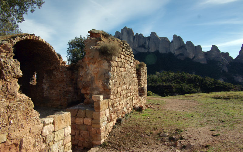
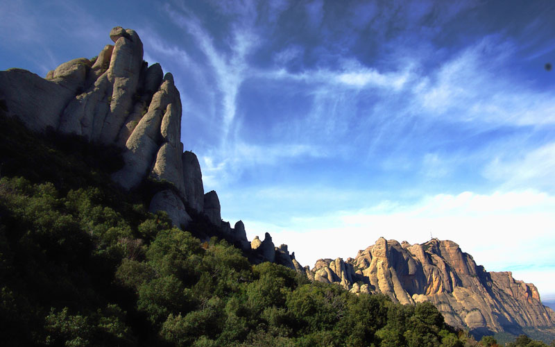
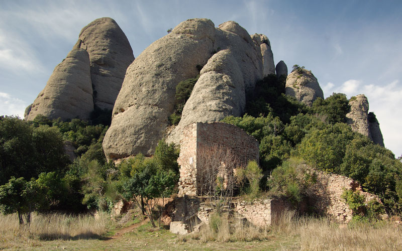
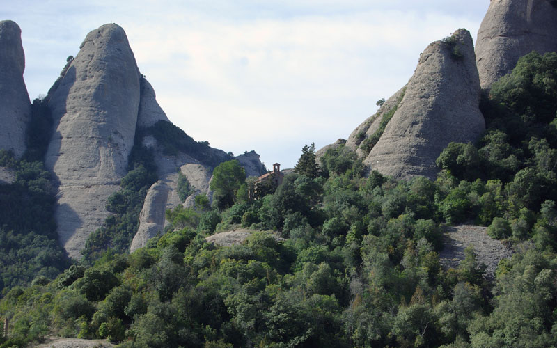
Further ahead you will see a path on the right that leads to the old Romanesque Church of Sant Pau Vell, which dates from 1084. In the same place, you will see an information panel featuring the names of the entire group of pinnacles collectively known as Les Agulles. A bit higher up, on the hill, you will see the remains of the old fortress known as the Castell de la Guàrdia or Castell de Bonifaci, which was first documented in the year 973. To see it from closer up, you will need to take the path on the right, and in just two minutes, you will be on top of the hill.
Tracing your steps back along the Camí de Sant Pau Vell, you will return to the main trail towards Roca Foradada and La Cadireta. Be sure to follow the Montserrat Monastery (“Monestir de Montserrat”) signs at all times, along GR - 172.
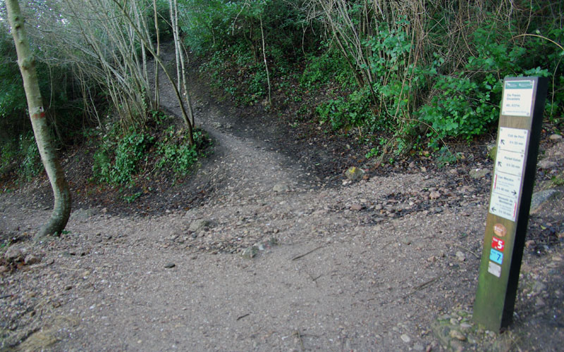
You will come to a flat clearing at a mountain pass known as the Coll de Guirló. On your right, a trail would take you down along the stream Torrent de la Diablera. Do NOT take this trail. Instead, continue straight on.
After passing a narrow wooden crossing that limits the passage of bicycles and horses, you will immediately come to a crossroads with a sign marking the path that leads to the Refugi Vicenç Barbé mountain retreat. Here, you will once again continue straight on, towards the Monastery, hence walking along the north face of the Les Agulles rock formations.
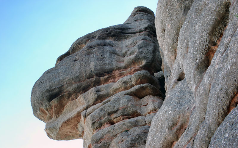
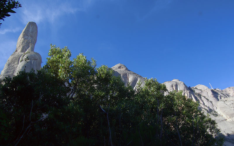
The trail will bring you just beneath the rock formation La Cadireta, and next to it, Roca Foradada. Be sure to stop and look up at the ceiling of the La Cadireta from beneath, as it is spectacular.
You will soon come to another crossroads, which this time provides access to the Coll de Port pass. Here, you will continue to the left, descending slightly as you move towards the Monastery, in keeping with the sign.
At this point, you will leave behind the rocky pinnacles of the Les Agulles and enter the area of the Els Frares Encantats. If you look back over your shoulder, you can still see the Roca Foradada from the other side. A bit further ahead, your trail will bring you to another crossroads, with a trail off to the left. This is one of the accesses that lead down to the highway. Nevertheless, you will continue straight on, along the trail that you have been following.
As of this point, you will begin to see frequent small clearings with blackish soil. This phenomenon was caused by the old holm oak charcoal production constructions. Soon, you will come to another Park sign that indicates that you have reached the Canal del Miracle stream.
At this point, you will go down a section of stairs to see the Monastery of Santa Cecília. The trail to the left zigzags down to the highway, although you will continue to the right, in keeping with the indications of the sign.
Cross the small stream, Canal de la Font de la Llum, and a few metres later, you will come to the junction with the narrow path that descends from the Portell de Migdia pass. Follow the descent to the left, as you head towards the Monastery of Montserrat. You are now beneath the rocky outcrops of the Els Ecos and the Roques del Salt de la Nina. Here, you will see another trail on the left that leads to the highway, yet you must stick to your trail and continue straight on.
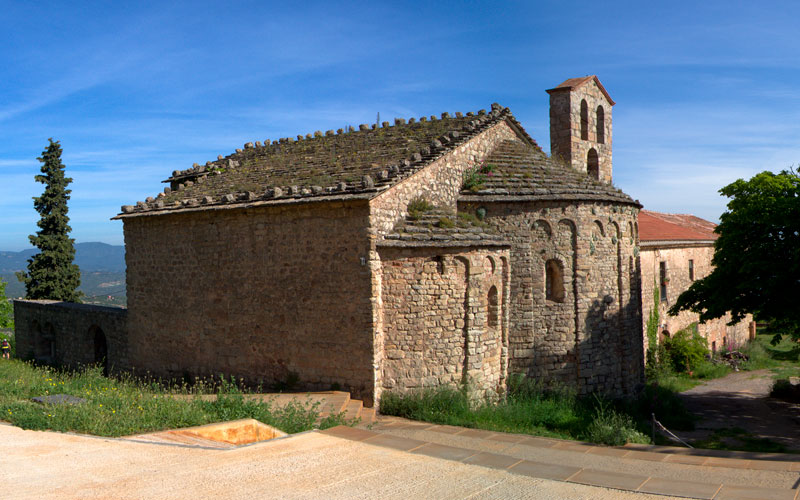
You are about to reach the level of the Monastery of Santa Cecília. From the trail, you are sure to enjoy the view of the 11th-century Romanesque structure, which was built in 945 by Abbot Cesari. This is a Romanesque church with a basilica layout, with three naves. It has remained in good condition thanks to several refurbishments and specifically thanks to the current refurbishment (2014-2015). The building next to it is the Refugi Bartomeu Puiggròs, a mountain retreat owned by the Catalan Trekkers’ Federation (FEEC).
Cross the stream Canal de Sant Jeroni and continue straight on until you come to the next fork in the trail, which leads to Santa Cecília.
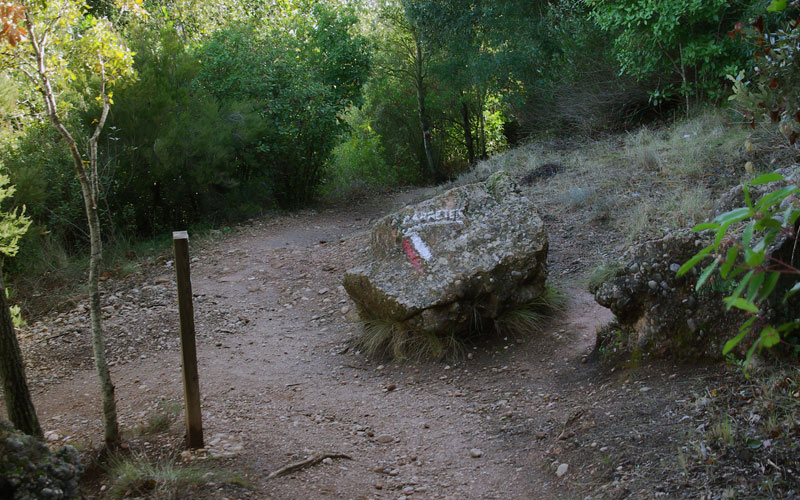
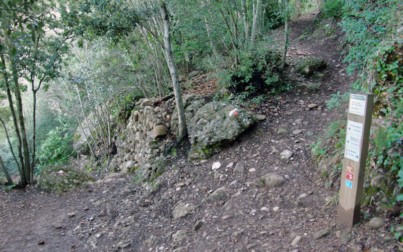
Be careful not to get distracted in this area, as there are a number of different narrow paths that run down to the highway. You will need to follow the red and white markings of the GR - 172.
Your trail will now climb for a while until you find yourself below the towering wall of the Paret de l’Aeri, at which point the trail flattens out, bringing you to the Paret dels Diables, with the striking Cavall Bernat looming in front of you.
Once you have passed the Cavall Bernat, you will leave the Canal del Cavall stream behind on the right and continue beneath the jagged peaks of Les Lluernes, until you come to the crossroads of the Canal del Pou del Gat.
Continue alongside the rocky area of Els Flautats, keeping this area on your right at all times. If you look back over your shoulder, you will see much of the mountain face that you have covered in the last section: Flautats, Lluernes, Cavall Bernat, Diables and Ecos.
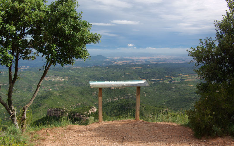
You will continue to climb along this path until you reach a large plateau, where you will see the intersection of four trails. This is the Pla de la Trinitat. From here —or if you climb up a bit higher to the right— you will see the stones and the old Ermita de la Trinitat, which was once the largest hermitage in Montserrat’s high mountain area.
Return to the plateau and continue straight along the GR towards the monastery (“Monestir”). This zone will afford you breathtaking views of the area of Les Gorres, and on your right, the area of Sant Benet, with the striking peaks of outcrops such as La Mòmia, l’Elefant and a bit further out, La Prenyada; with the Hermitage of Sant Benet nestled beneath them.
Next, you will pass through the remains of a gate in disuse, until you reach the crossroads of Sant Benet. Leave the stairs behind you on the right, and begin your descent to the plateau known as the Pla de Santa Anna.
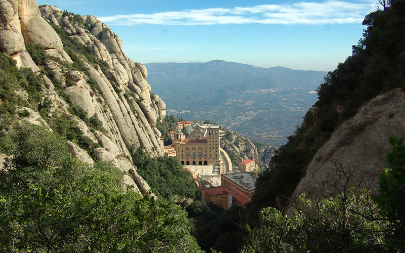
Before you get to the Pla de Santa Anna, you will see a small lookout on the left, hidden behind the trees of the trail. This viewpoint offers a nice view of the Basilica of Montserrat. At the next crossroads, you will turn left and immediately come to the stairs, which will bring you down to the Monastery.
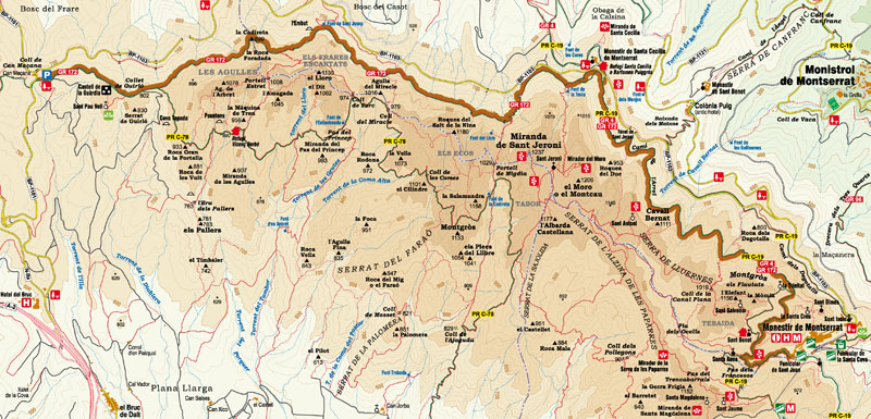
Route Map
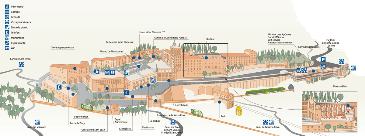
Map of services on Montserrat
Park Rules and Regulations
- Respect private property. Do not walk across cultivated meadows or crop fields.
- Respect cultural and historical heritage. It must be preserved for future generations.
- The capture and/or collection of animals, rocks, minerals or plants is forbidden throughout the Nature Park.
- It is forbidden to discard any kind of rubbish throughout the Nature Park. Always use the bins or take away any rubbish you may have.
No fires must be lit anywhere in the Nature Park.- Free camping is forbidden throughout the Nature Park. For more information on where you can stay, contact the Nature Park's Tourist Information Office.
- Do not make any unnecessary noise. Respect the quiet, especially where birds are nesting.
- All wheeled vehicles are forbidden throughout the Nature Park except on paths and routes open to the public.
- Dogs must be on a lead to ensure they can't disturb any wildlife.
- Walking is the best way to get to know the heritage of our natural places. Follow the signposted routes and paths as it's easy to get lost among the irregular terrain.
Warning! Risk of rock falls.
Basic Tips When on the Trail
- » Before leaving, check the weather conditions and how these might change. Do not undertake the walk if the forecast is not good.
- » Particular care must be taken on cold winter days, in the rain or mist and on hot summer days.
- » Plan your walk and its duration, consulting the guides and the map of the route.
- » Equip yourself adequately for the walk as the weather can change very quickly.
- » Never go alone or at least inform someone of your intended walk. When in a group, always remain in contact with the rest of the party.
- » Keep within your possibilities and remember you have to make the return journey. Carry water in your backpack, drink frequently and eat energy-giving foods.
- » Do not leave the signposted routes or take any shortcut as this results in land erosion.
- » Don't leave any rubbish in the park. Take it with you and place it in the containers or bins provided for the purpose.
- » Hunting is controlled on the mountain in order to maintain a balanced population of game. When planning your walk, consult the dates planned for boar hunts each season.
- » Should an accident occur, call the emergency services on 112. Keep calm and provide the following information:
- →Number of people involved and their age
- →Location of the accident
- →Status of the people involved: Are they injured? Conscious? Bleeding? Breathing?
- →Weather conditions at the location of the accident
Further information
Contact the office of the Montserrat Mountain Nature Park:
Plaça Abat Oliba, s/n, Tel. 938350644Visit our website: